





















































































Interpreting Geopolitical Data: Methodological Challenges and Innovations
Geopolitical data is challenging to interpret due to its inherent complexity, bias, and methodological limitations. This article explores these challenges through hypothetical scenarios, employing advanced methodologies to enhance understanding and validity in geopolitical studies.

Imagine an international summit where world leaders are presented with data showing a sudden shift in global energy consumption patterns. Such data could have profound implications for geopolitical strategies, yet the interpretation of these data is fraught with complexity. Geopolitical data, by its nature, is interwoven with layers of causality, bias, and validity concerns that challenge the very foundation of methodological rigor in international relations research.


At the core of interpreting geopolitical data lies the challenge of causality. In a typical scenario, consider a series of economic sanctions imposed by one nation on another. Researchers might ask: do these sanctions directly cause a shift in the sanctioned nation's economic policies, or are other factors at play? The difficulty of drawing causal inferences in such complex scenarios cannot be overstated. Traditional methods like covariance analysis may fall short, leading researchers to explore advanced methodologies such as counterfactual simulations and machine learning algorithms. These approaches aim to isolate causal pathways by simulating alternative scenarios, offering a more nuanced understanding of geopolitical phenomena.
Bias and Its Influence on Geopolitical Data Interpretation
Bias in geopolitical research often stems from the selective inclusion of variables or data sources. Consider a behavioral experiment where researchers analyze media coverage of international conflicts. The choice of media outlets can introduce bias based on political affiliations or regional focus. Such bias skews the interpretation of geopolitical trends, potentially leading to misguided policy recommendations.
To address bias, methodologists employ a range of techniques. One approach involves multi-source triangulation, which combines data from diverse sources to mitigate individual biases. For instance, integrating governmental data with independent non-governmental organization (NGO) reports can provide a more balanced view. Additionally, artificial intelligence models are increasingly used to detect and correct bias, by identifying patterns that human analysts might overlook.
Another challenge is confirmation bias, where researchers may unconsciously favor data that supports pre-existing theories. To counter this, teams employ blind analysis techniques, ensuring that those interpreting the data are unaware of the specific hypotheses being tested. This reduces the risk of bias influencing conclusions, fostering a more objective examination of geopolitical data.
Ensuring Validity in Geopolitical Research
Validity in geopolitical research examines whether the data and conclusions accurately represent reality. In a typical observational study of international trade relations, researchers must ensure their data collection and analysis processes are sound, avoiding pitfalls such as misinterpretation or overgeneralization.
One innovative approach to enhancing validity is the use of dynamic systems modeling. This method captures the complexities of geopolitical interactions by simulating the feedback loops and non-linearities inherent in global relations. By accounting for these dynamics, researchers can produce more valid models of geopolitical phenomena.
Additionally, longitudinal studies that track geopolitical variables over extended periods contribute to validity by revealing trends that short-term studies might miss. Such studies require rigorous methodological frameworks to maintain consistency and accuracy across temporal spans.
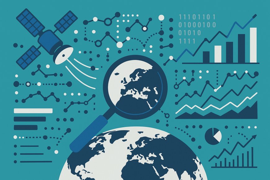
Consider the hypothetical case of evaluating the impact of climate change on geopolitical stability. Researchers might use a combination of satellite data analysis and historical climate records to construct a valid narrative. By integrating diverse data sources and employing robust statistical techniques, the study can provide actionable insights into the geopolitical consequences of environmental shifts.
Innovations in Methodological Approaches
The advancement of technology continues to influence the methodological landscape of geopolitics. The integration of big data analytics and geospatial information systems (GIS) provides unprecedented insights into geopolitical patterns. For example, a case study might involve analyzing satellite imagery to assess infrastructure development in conflict-prone areas. By correlating these images with economic and social data, researchers can uncover hidden dynamics that traditional methods might miss.
Moreover, the rise of interdisciplinary approaches, combining insights from political science, data science, and economics, enhances the depth of geopolitical research. Such synergy allows for the creation of comprehensive models that can better anticipate geopolitical shifts. In an experimental setup, a team might employ machine learning algorithms alongside econometric models to predict the outcomes of political elections, providing a contemporary lens through which to view electoral trends.
The integration of advanced visualization tools also plays a crucial role in interpreting complex geopolitical data. Interactive dashboards and virtual reality environments enable policymakers to engage with data more intuitively, fostering informed decision-making processes.
In the ever-evolving domain of geopolitics, methodological innovations are not merely beneficial but essential. As researchers continue to refine these methodologies, the potential for new insights into global relations expands, promising a future where geopolitical data is analyzed with unprecedented precision and clarity.
What's Your Reaction?